Winter Storm Names Point to Different Hazards
Blizzards, snowstorms, and ice storms are often grouped together because they arrive in cold weather and disrupt travel, but they are not the same event. A blizzard is defined mainly by wind and visibility, a snowstorm by accumulating snow, and an ice storm by freezing rain that coats surfaces. The difference matters because each one creates a different kind of danger. One can trap drivers in a whiteout, another can bury roads under heavy snow, and another can bring down trees and power lines under the weight of glaze ice. Understanding the terms helps people read forecasts more accurately and respond to the hazard that is actually developing.
A: No. A blizzard depends on wind, visibility, and duration, not snow amount alone.
A: Yes. Blowing snow on the ground can create ground blizzard conditions.
A: Freezing rain coats surfaces with glaze ice instead of piling up as snow.
A: No. Sleet freezes before landing, while freezing rain freezes on contact.
A: Ice storms are often worst because ice adds weight to trees and lines.
A: Yes. Temperature layers can shift snow to sleet, freezing rain, rain, or back to snow.
A: They point to the main expected hazard and the response people should take.
A: Not necessarily, though wind chill can make exposure more dangerous.
A: Ice can remove traction even when the road only looks wet.
A: Check the expected precipitation type, wind, visibility, timing, and outage risk.
A Snowstorm Is About Falling Snow
A snowstorm is the broadest of the three terms. It describes a storm that produces snow, often enough to affect roads, schools, flights, and daily plans. The snow may be light and fluffy, wet and heavy, steady for many hours, or intense for a shorter period. The defining feature is precipitation type and accumulation rather than a strict wind or visibility threshold.
Snowstorms can still be dangerous without becoming blizzards. Heavy snow can reduce traction, hide lane markings, load roofs, break branches, and slow emergency response. Wet snow can be especially hard on shoveling, plowing, and power lines because it sticks and compacts. A calm snowstorm may look less dramatic than a whiteout, but it can still produce serious disruption.
Forecasts for snowstorms usually emphasize snow totals, timing, road impacts, and whether the snow will be wet or powdery. Those details tell people when travel will be hardest and what cleanup will require.
A Blizzard Is About Wind and Visibility
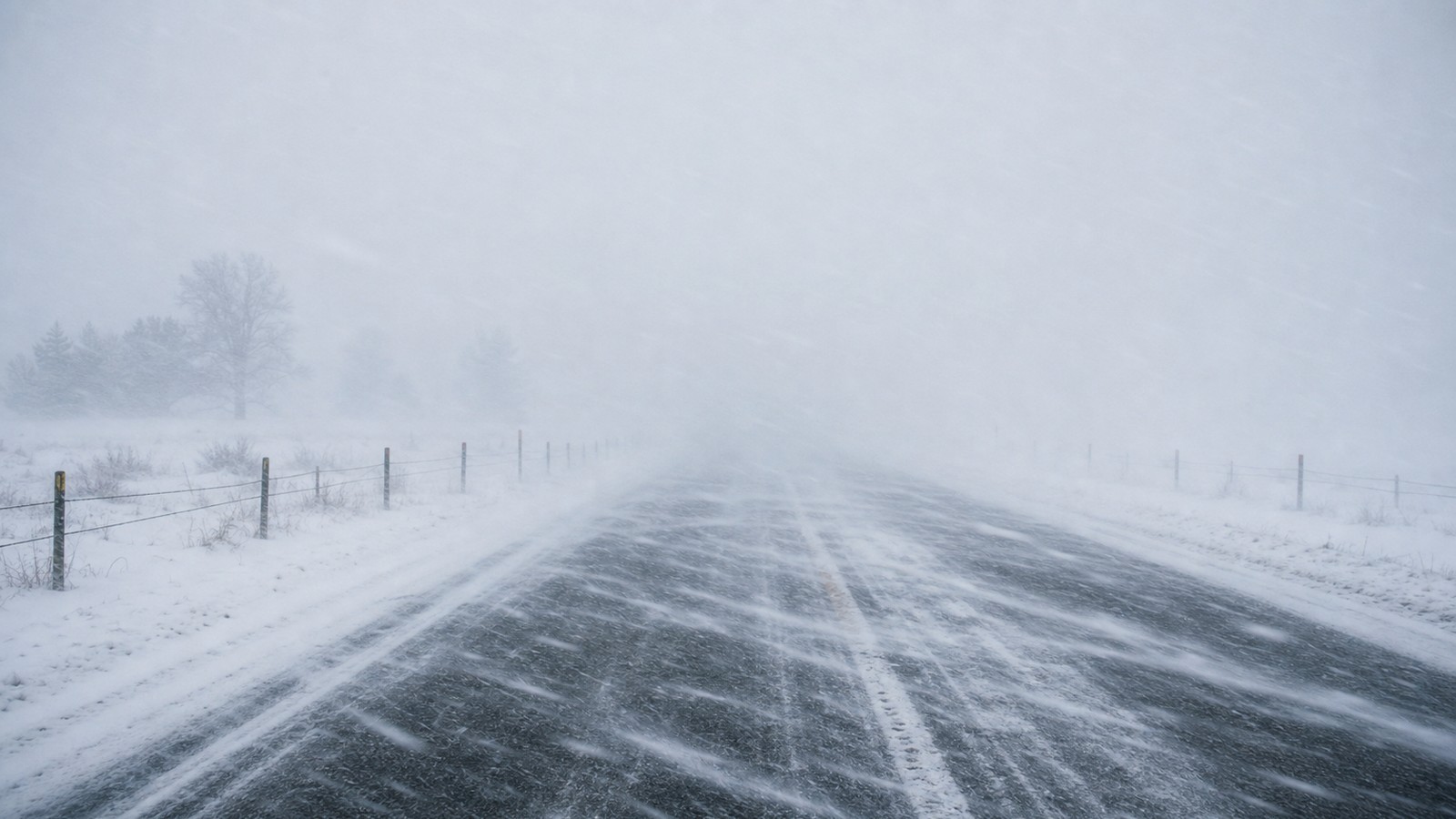
A blizzard does not require the largest snow total in the region. It requires strong wind, severely reduced visibility from falling or blowing snow, and conditions that last long enough to create sustained danger. This is why a storm with moderate snow but fierce wind can be more dangerous for travel than a deeper snowfall with light wind. The key hazard is disorientation. In a blizzard, drivers may lose the road edge, plows may not keep up with drifting, and people outside may struggle to find shelter. Whiteout conditions can make familiar places feel unfamiliar because the horizon, pavement, signs, and nearby landmarks disappear.
A blizzard warning should be read as a mobility and exposure warning. The message is not simply that snow is falling; it is that wind and snow are combining to make movement hazardous or impossible.
An Ice Storm Is About Freezing Rain
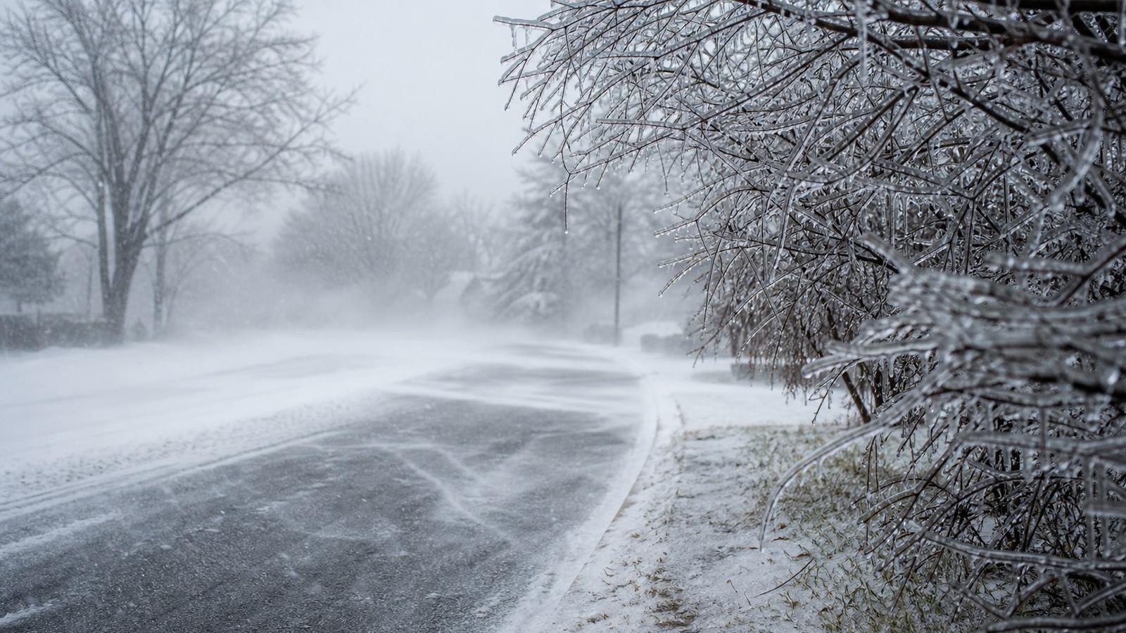
An ice storm forms when rain falls into a shallow layer of below-freezing air near the ground and freezes on contact with roads, trees, wires, and other exposed surfaces. Unlike sleet, which freezes into pellets before reaching the ground, freezing rain remains liquid until it touches something cold. The result is a coating of clear glaze ice.
That coating can be beautiful and destructive at the same time. Even a modest amount of ice can turn sidewalks and roads into slick surfaces. Larger accumulations weigh down branches and power lines. When wind follows the ice, the stress can increase and outages can spread.
Ice storms are often judged by accretion rather than depth. A quarter inch of ice can matter more than several inches of dry snow because ice bonds to surfaces and adds weight where structures are least prepared to carry it.
Winter Storms Can Change Type During One Event
Many winter storms do not stay in one category from start to finish. A system may begin as snow, change to sleet, shift to freezing rain, and then end as rain or snow again. The exact sequence depends on temperature layers above the ground, surface temperature, storm track, and how quickly cold air is replaced or reinforced. This transition zone is where forecasts can feel complicated. A small change in temperature may decide whether a town gets six inches of snow, a damaging glaze of ice, or a messy mix. Two nearby communities can experience very different hazards from the same storm because the warm layer aloft or cold surface air sets up differently.
That is why winter forecasts often mention precipitation type, not just storm strength. Knowing what will fall from the sky is only half the story; knowing what it will do when it reaches the ground is just as important.
The Road Hazards Are Not the Same
A snowstorm usually makes roads slippery by covering them. Drivers may still see the lane and judge the surface, but traction is reduced and stopping distances grow. Plowed snowbanks, slush, and compacted snow can create additional problems after the heaviest snow ends.
A blizzard makes roads dangerous by removing visibility and creating drifting. The surface may be snow covered, partly cleared, or repeatedly buried by wind. The problem is not only slickness; it is the inability to see where to go or whether another vehicle, drift, or closure is ahead.
An ice storm can make a road look deceptively wet while it is actually glazed. Bridges, ramps, shaded roads, and untreated sidewalks can become hazardous quickly. Ice is often harder to correct with ordinary driving skill because tires may have little grip at all.
Power Outage Risk Comes From Different Mechanisms
Snowstorms cause outages when heavy wet snow sticks to trees and lines or when wind accompanies the snow. Dry powder snow is usually less damaging to branches because it does not cling as strongly. The outage risk rises when snow has high water content or when trees still carry leaves early in the season. Blizzards can cause outages through wind, drifting, and extreme access problems. Even if the snow itself is not especially wet, crews may be unable to reach damaged areas until visibility improves and roads are reopened. A short outage can become harder when travel remains unsafe.
Ice storms are notorious for power outages because freezing rain coats every exposed surface. Branches sag, lines accumulate weight, and poles or towers may fail under combined ice and wind. Restoration can take time because crews must work around falling limbs and slick access routes.
Warning Language Tries to Match the Main Threat
Winter weather alerts are not interchangeable labels for bad weather. A winter storm warning may focus on heavy snow, a blizzard warning on wind-driven whiteout conditions, and an ice storm warning on damaging ice accretion. The alert name points toward the dominant hazard forecasters expect.
That distinction helps people choose the right response. Heavy snow may call for changing travel times and preparing to shovel. Blizzard conditions may call for canceling travel entirely before visibility collapses. Ice storm risk may make power backup, tree hazards, and walking safety the top concerns.
The safest interpretation is to read the full forecast discussion or alert text, not only the headline. The details explain timing, amounts, temperature changes, and what hazard is expected to create the greatest impact.
Why The Same Storm Can Be Named Differently By Different People
Everyday language is looser than meteorological language. People may call any major winter storm a blizzard because it felt severe, even if official criteria were not met. Others may call a mixed event a snowstorm because snow was the most visible part, even though freezing rain caused the worst damage. Local memory also shapes the label. A community that lost power for days may remember an event as an ice storm, while a nearby rural area remembers impassable roads and whiteout travel. Both descriptions can be emotionally true, but they emphasize different impacts.
For safety decisions, the technical distinction is more useful than the casual name. Ask what the storm is doing: reducing visibility, accumulating snow, glazing surfaces, producing wind chill, or changing precipitation type.
Preparation Should Follow the Hazard
For snowstorms, preparation often centers on travel timing, snow removal, medication, food, and plans for delayed services. People should expect slower roads, possible school closures, and cleanup that may continue after snow ends. Wet snow also requires caution during shoveling because it is heavy.
For blizzards, the priority is avoiding exposure and travel before conditions collapse. A vehicle emergency kit is useful, but it should not encourage driving into a whiteout. Staying put is often the safer decision when wind and visibility are the main hazards.
For ice storms, preparation should include power outage plans, safe heat use, phone charging, traction on walkways, and awareness of falling branches. Walking outside can be hazardous even when roads appear passable.
Local Geography Decides Which Hazard Wins
The same winter storm can feel like three different storms across one region. A valley may hold shallow cold air and receive freezing rain while hills nearby stay all snow. A lakeshore town may see heavy lake-enhanced snow while an inland community deals mainly with wind and drifting. Elevation, water bodies, urban heat, and terrain all change what reaches the ground. Local geography also shapes consequences. Open farmland is more vulnerable to blowing snow and ground blizzards. Tree-lined neighborhoods are more vulnerable to ice-coated branches falling into wires. Mountain passes can become dangerous from snow rate, wind, and steep roads even when nearby towns are mostly wet.
This is why the safest winter forecast is local rather than regional. A broad storm headline tells you a system is coming; the local forecast tells you whether the main problem is accumulating snow, whiteout wind, or ice.
Timing Can Change The Same Forecast Into A Different Risk
A snowstorm beginning before dawn can disrupt commuting before plows have made repeated passes. The same snow beginning late at night may give crews more time to work before traffic builds. Ice arriving during the evening can coat untreated roads just as temperatures fall and visibility drops.
Blizzard timing is especially important because the travel window can close quickly. Roads that look manageable at noon may be impassable by midafternoon once wind increases and fresh snow becomes available to blow. People who wait for conditions to look bad may wait too long.
For ice storms, timing around temperature matters. A few hours of freezing rain before a warmup may create slick surfaces but limited tree damage. A longer period below freezing can build enough ice to cause outages and dangerous walking conditions.
Forecast Uncertainty Is Usually About Temperature Layers
When winter forecasts change, the reason is often not that the storm disappeared. It is that the vertical temperature profile shifted. A warm layer above the surface can melt snowflakes into raindrops, while shallow cold air at the ground can refreeze them on contact. A small change in the depth of either layer can flip the forecast from snow to sleet or freezing rain. This uncertainty is most common near the rain-snow line and in areas where cold air drains into valleys or is trapped against mountains. Forecasters may know a strong storm is coming while still refining the exact precipitation type for each town. That detail matters because the response to six inches of snow is not the same as the response to a quarter inch of ice.
The practical move is to watch forecast updates as the storm approaches. Confidence usually improves as observations show where the cold air is holding and how the warm layer is evolving.
The Practical Difference
The simplest distinction is this: snowstorms are about snow accumulation, blizzards are about wind-driven visibility loss, and ice storms are about freezing rain coating surfaces. Each can be severe, and each can overlap with the others, but they should not trigger the same mental checklist.
A forecast becomes clearer when the label is translated into the actual hazard. Will roads be buried, will visibility disappear, or will ice coat trees and pavement? That question points to the safer decision faster than arguing over which winter word sounds most dramatic.
Winter storms are easier to respect when their differences are clear. The right name helps people prepare for the danger in front of them, not the one they are imagining.