Supercells Give Rotation Time to Organize
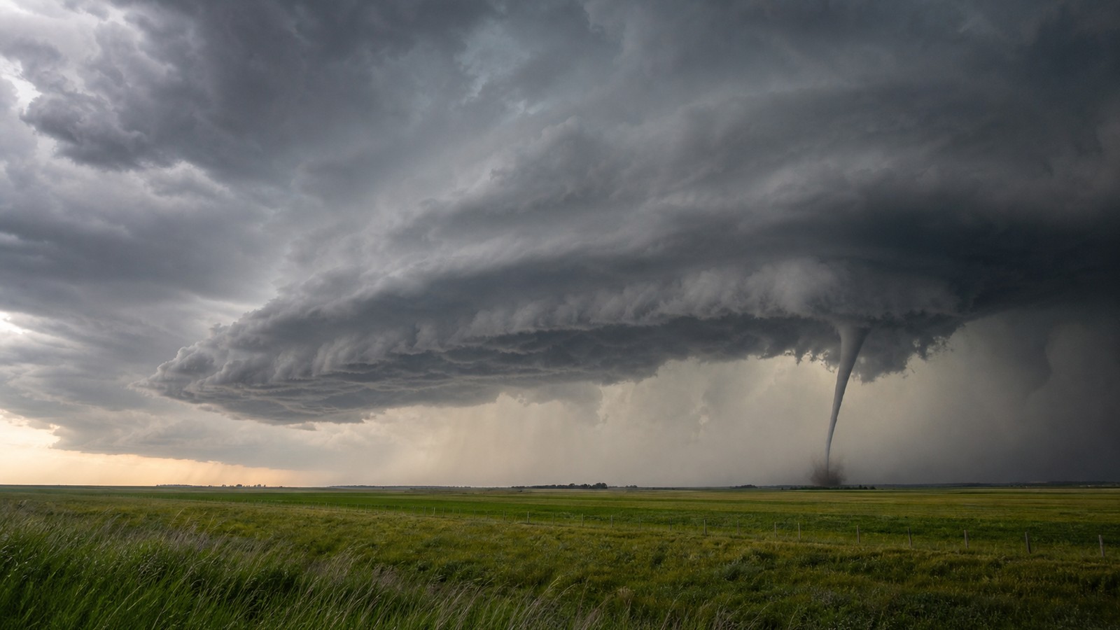
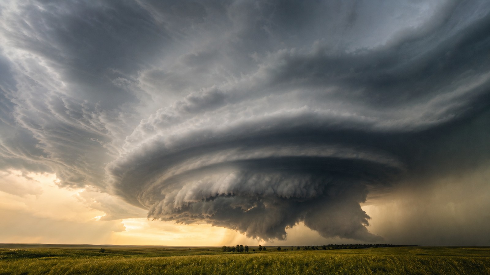
Supercell thunderstorms are the classic producers of the most dangerous tornadoes because they contain a persistent rotating updraft called a mesocyclone. Unlike ordinary thunderstorms that grow, rain out, and collapse quickly, a supercell separates its updraft from its downdraft well enough to survive for hours. That structure lets the storm ingest warm moist inflow, tilt and stretch wind shear, cycle through periods of strengthening, and focus rotation near the ground. A supercell does not automatically produce a tornado, and many impressive rotating storms never do. But when the low-level environment is right, the storm’s organization can turn broad rotation into a tight surface circulation. The strongest tornadoes usually require not only a powerful storm, but a storm arranged in a way that keeps the inflow, updraft, rear-flank downdraft, and low-level rotation working together.
A: It has a persistent rotating updraft that lets the storm stay organized.
A: No. It means the storm rotates, but surface spin-up may not occur.
A: The storm can maintain and stretch rotation longer than ordinary thunderstorms.
A: It is a lowered cloud base beneath the rotating updraft region.
A: Yes. Giant hail, damaging wind, flooding rain, and lightning are common hazards.
A: It is repeated weakening and redevelopment of low-level rotation in one storm.
A: It keeps warm moist air feeding the updraft without nearby storm interference.
A: They can be, because tornadoes are harder to see and people may be asleep.
A: Terrain can modify storms, but it does not reliably prevent tornadoes.
A: Move to sturdy lowest-floor shelter and stay there until the warning clears.
The Mesocyclone Is the Supercell’s Engine Room
A mesocyclone is a broad region of rotation inside a thunderstorm’s updraft. It forms when vertical wind shear is tilted and stretched by rising air. In a supercell, that rotating updraft persists rather than being quickly undercut by rain-cooled air. This persistence gives the storm a long-lived internal structure that ordinary pulse storms lack.
The mesocyclone is usually several miles wide, while a tornado is much smaller. A tornado can form within the broader rotating environment if low-level rotation tightens dramatically near the surface. That tightening depends on the storm’s internal airflow as much as the large-scale weather setup.
Because the mesocyclone is larger than the tornado, radar may show rotation before a tornado exists. Forecasters watch whether that rotation lowers, tightens, strengthens, and aligns with other storm features. The dangerous step is the transition from organized storm-scale rotation to a damaging ground circulation.
Inflow Feeds the Rotating Updraft
Supercells need inflow: warm moist air streaming into the storm. This inflow supplies buoyant air for the updraft and helps maintain the storm’s separation between rising and sinking air. If inflow remains strong and undisturbed, the storm can keep drawing energy from the boundary layer near the ground.
The quality of inflow matters. Air that is warm, moist, and not too rain-cooled can keep the low-level updraft buoyant. If the storm is ingesting stable air from its own cold outflow, tornado potential may decrease. If the storm can remain rooted in favorable surface air, low-level rotation has a better chance to intensify.
This is why forecasters care about boundaries, dew points, and storm interactions. A supercell crossing a warm front or outflow boundary may suddenly gain stronger low-level shear or richer moisture. Another supercell may weaken when a nearby storm contaminates its inflow.
The Rear-Flank Downdraft Can Help or Hurt
The rear-flank downdraft is a descending current of air that wraps around the backside of many supercells. It is often involved in the final stages of tornado formation because it can help concentrate rotation near the ground. But it is not automatically helpful. Its temperature, moisture, speed, and placement matter.
If the downdraft is too cold and dense, it can surge under the updraft and cut off the storm’s warm inflow. That undercutting may leave rotation elevated above a stable layer. If the downdraft is less cold and better balanced, it may help tighten the low-level circulation without choking it.
This delicate balance is one reason tornado prediction is hard even during obvious supercell outbreaks. Two storms in similar environments can behave differently because their downdrafts evolve differently. A small storm-scale difference can separate a photogenic non-tornadic supercell from a violent tornado producer.
Low-Level Shear Is the Tornado Ingredient
Deep-layer shear helps a storm become a supercell, but low-level shear is especially important for tornado potential. Winds that turn and strengthen rapidly in the lowest kilometer of the atmosphere create streamwise vorticity that the storm can ingest. In plain language, the storm receives spin that is already aligned in a useful way.
A strong low-level jet often increases this shear during evening or overnight hours. That can keep tornado risk alive after dark, even as surface temperatures cool. If instability remains sufficient and storms stay surface-based, nighttime supercells can be extremely dangerous because people are harder to warn and tornadoes are harder to see.
Low-level shear does not act alone. The storm must also maintain an updraft that can stretch the rotation, and the near-ground air must remain supportive. Strong shear with weak instability may produce rotating showers. Strong instability with weak shear may produce messy storms. Dangerous supercells need the combination.
Why Some Supercells Cycle Tornadoes
A long-lived supercell can produce more than one tornado as its internal structure evolves. The low-level mesocyclone may tighten, produce a tornado, become wrapped in rain or outflow, weaken, and then reorganize slightly downstream. This process is often called cycling. It is one reason a single warning can cover repeated tornado threats.
Cycling can make the storm look temporarily less dangerous before it tightens again. A first tornado may rope out while a new circulation develops nearby. People who leave shelter too soon may be exposed to a second circulation. Forecasters track these cycles by watching velocity trends, reflectivity structure, debris signatures, and spotter reports.
The most dangerous outbreaks often involve supercells that remain discrete long enough to cycle repeatedly. When storms merge into lines, the tornado threat may change character. When supercells stay isolated, their inflow can remain cleaner and their mesocyclones can remain stronger.
Storm Mode Changes the Threat
Storm mode describes whether storms are isolated, clustered, or arranged in lines. Isolated supercells often have the greatest potential for strong tornadoes because each storm can access undisturbed inflow. Clusters can interfere with one another, but they can still produce tornadoes if embedded circulations organize. Lines can produce quick spin-ups and damaging wind.
Discrete supercells are watched closely because their structure is easier to maintain. They can build large hail, strong mesocyclones, and pronounced hook echoes. But a messy storm day is not automatically safe. Embedded tornadoes inside rain and wind can be harder to recognize and may provide less visual warning.
For public safety, the storm mode changes how threats arrive. A single supercell may give a focused path of danger. A line may bring a broader surge of wind and brief tornadoes. Both deserve attention, but the strongest long-track tornadoes most often come from organized supercells.
Terrain and Boundaries Can Modify Supercells
Supercells do not exist in a laboratory. Hills, drylines, warm fronts, sea breezes, outflow boundaries, and urban heat patterns can all modify local airflow. A storm encountering a boundary may strengthen rotation by ingesting air with greater horizontal vorticity. It may also weaken if the boundary introduces stable air.
Boundaries are especially important because they can focus lift and enhance low-level shear. Many tornado events involve storms interacting with subtle boundaries that are hard to see without surface observations and radar. A storm that looked ordinary may become more threatening as it crosses one of these zones.
This local complexity makes severe-weather days feel uneven. One county may see only heavy rain while another nearby county receives a tornadic supercell. The difference may come from a boundary, inflow quality, or timing that was only slightly different.
Supercell Safety Requires Early Decisions
When a supercell is warned or approaching, waiting for a visible tornado is a poor strategy. The storm may be rain-wrapped, the circulation may form quickly, or the tornado may be hidden by terrain. Strong supercells also produce giant hail and destructive wind, so standing outside to watch can be dangerous before a tornado exists.
The best response is to know your shelter location before storms arrive and move quickly when a warning includes you. Interior lowest-floor rooms, basements, and purpose-built shelters provide the best protection. Mobile homes and vehicles are unsafe during tornado warnings, especially when supercells are capable of strong tornadoes.
Supercells are fascinating because their structure is so organized, but that organization is exactly why they deserve respect. A storm that can maintain rotation for hours can change from beautiful to violent in minutes.
Radar Signatures Help Reveal the Hidden Core
Supercells often show radar patterns that help forecasters focus on the most dangerous part of the storm. A hook echo can appear when precipitation wraps around the rotating updraft. Velocity data can show inbound and outbound winds close together. Dual-polarization products can sometimes identify lofted debris when a tornado is already causing damage.
None of these signatures is perfect in isolation. A hook echo can exist without a tornado. A velocity couplet may be broad or elevated. A debris signature may not appear until damage has begun and debris has reached the radar beam. Forecasters look for agreement among the signatures, storm environment, spotter reports, and warning history.
For the public, radar signatures are less important than the warning. A person does not need to diagnose the hook echo to act safely. The value of radar is that trained meteorologists can see dangerous organization even when the storm is rain-wrapped or darkness hides the cloud base.
Spacing Between Storms Can Decide the Outcome
A supercell needs access to warm moist inflow. If other storms form too close, they can steal that inflow, spread cold outflow, or turn the region into a messy cluster. Sometimes that reduces strong tornado potential. Other times, storm mergers can briefly enhance rotation or create new boundaries that become dangerous.
This is why outbreak forecasts often discuss whether storms will remain discrete. A few isolated storms in a highly sheared environment can be more concerning for violent tornadoes than dozens of storms competing for the same air. The cap, dryline, warm front, and timing of lift all influence whether storms stay separated or crowd together.
Storm spacing also changes warning strategy. A discrete supercell may have a clearer track and more persistent mesocyclone. A cluster may produce embedded circulations that are harder to identify and communicate. Both can be dangerous, but they demand different kinds of attention.
Supercells Can Move Differently Than Nearby Storms
A mature supercell may turn to the right or left of the average storm motion because the rotating updraft changes how the storm interacts with the wind field. Right-moving supercells in the Northern Hemisphere are often watched closely because they can ingest strong streamwise vorticity and maintain powerful mesocyclones.
This deviant motion affects warning decisions. A storm may not follow the direction casual observers expect from the general cloud movement. A town that looks safely south or east of a storm may become more exposed if the supercell turns. Forecasters use storm-relative motion, radar trends, and environmental winds to update the projected path.
For people in the path, the lesson is to follow the warning polygon and updated alerts rather than guessing from the storm’s apparent direction. Supercells are organized enough to create their own motion surprises, especially during high-shear severe-weather days with discrete storms nearby and strengthening fast today locally.