A Tornado Is a Rotating Column That Reaches the Ground
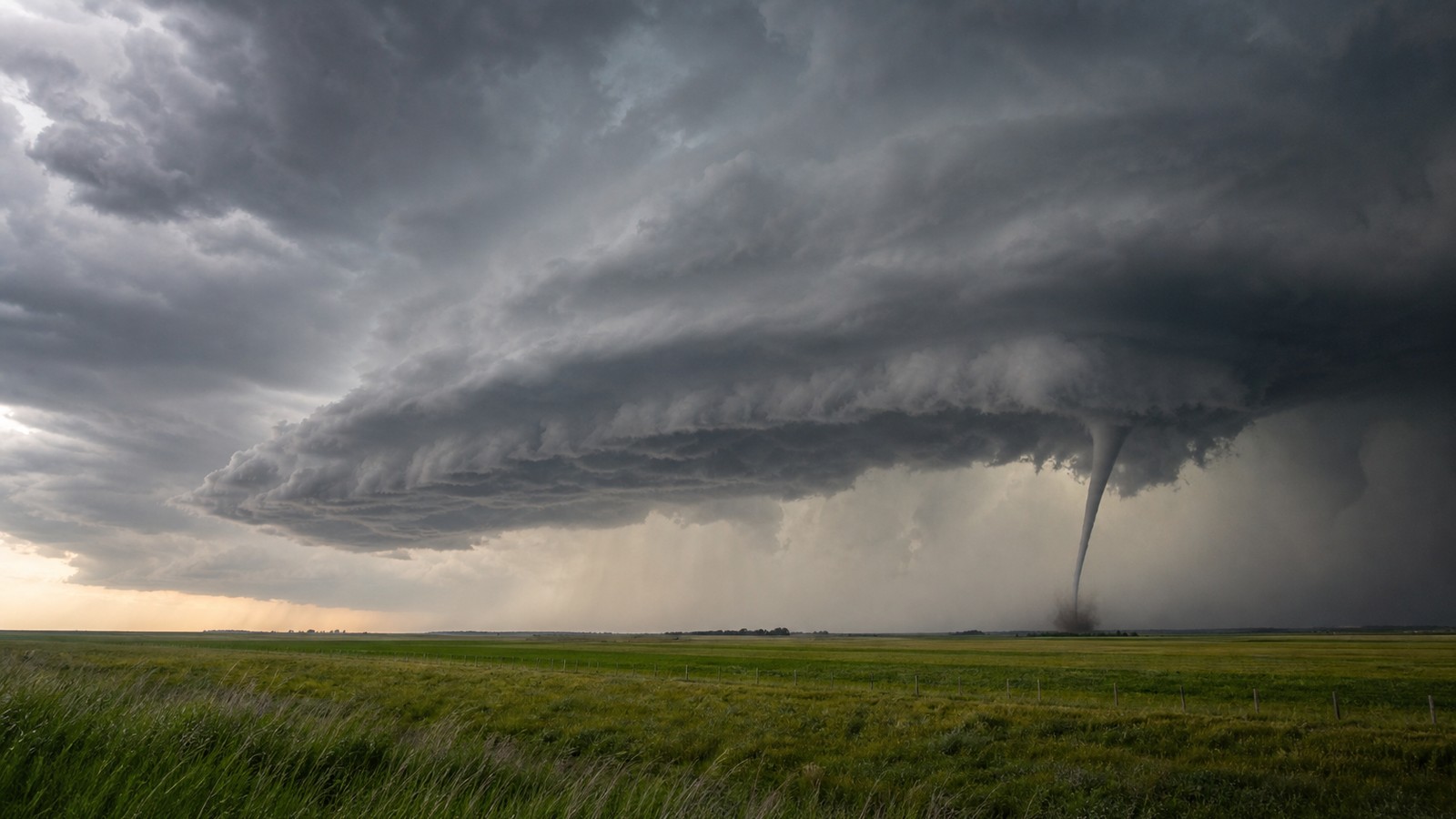
A tornado is a violently rotating column of air connected to a thunderstorm and in contact with the ground. That last part matters: many storms rotate aloft, many clouds lower beneath a storm base, and many funnel-shaped features never become tornadoes. A true tornado is the damaging circulation at the surface, whether or not a visible condensation funnel stretches all the way down. Tornado formation requires more than a dark cloud and strong wind. It usually depends on unstable air that rises rapidly, wind shear that creates rotation, a storm structure capable of stretching that rotation, and a near-ground environment that lets the circulation tighten instead of falling apart. The most violent tornadoes are often linked to supercell thunderstorms, but weaker tornadoes can also form in squall lines, landfalling tropical systems, and small boundaries under the right conditions.
A: Yes. It becomes a tornado only when the circulation reaches the ground.
A: No. Many rotate strongly aloft but never tighten a surface circulation.
A: They are harder to see and often catch people asleep without multiple alerts.
A: No. Width and damage rating are related imperfectly and must be surveyed.
A: Yes, if instability, shear, moisture, and lift overlap.
A: Heavy precipitation hides the tornado from view, making radar and warnings critical.
A: No. Use that time to shelter immediately.
A: No. Buildings and urban heat do not prevent tornado formation.
A: The visible damage path can vary as the circulation changes intensity and contact.
A: Get to a lowest-floor interior shelter as soon as a warning includes you.
Rotation Begins With Wind Shear
Wind shear means wind changes speed or direction with height. Near the ground, air may blow from the southeast while stronger winds aloft blow from the southwest or west. That change can create horizontal tubes of spinning air in the lower atmosphere. By itself, that rotation lies on its side and is not yet a tornado.
A thunderstorm updraft can tilt some of that horizontal rotation into a vertical position. Once vertical, the spin can become part of the storm’s rotating updraft. Meteorologists call that rotating updraft a mesocyclone when it is broad and persistent inside a supercell. The existence of a mesocyclone raises concern, but it still does not guarantee a tornado.
The important idea is that tornadoes are not simply caused by two air masses crashing together. Boundaries can help focus storms, but rotation comes from the wind profile and how the storm stretches it. The atmosphere has to provide both fuel for rising air and turning motion for the storm to organize.
Instability Gives the Storm Lift
Instability describes air that can rise vigorously once it is lifted. Warm moist air near the surface beneath cooler air aloft creates buoyancy. If that air begins rising, it can accelerate upward, condense into cloud, release latent heat, and build a tall thunderstorm. Stronger instability can support stronger updrafts, which are better able to stretch rotation.
Stretching is crucial because rotating air spins faster when it is pulled narrower, much like a skater spinning faster with arms tucked in. A thunderstorm updraft can stretch a broad area of rotation into a tighter column. If the lowest part of that rotation also intensifies near the ground, tornado formation becomes possible.
Instability alone is not enough. A humid summer day can produce tall thunderstorms that rain hard but never rotate meaningfully. Shear alone is not enough either. A windy cool day may have turning motion but no deep storm to tilt and stretch it. Tornado risk rises when instability and shear overlap in the right place at the right time.
The Funnel Is Not the Whole Tornado
People often picture a tornado as a visible funnel cloud, but the damaging circulation can reach the ground before the funnel appears complete. A funnel becomes visible when pressure drops enough and moisture condenses inside the rotating column. Dust, debris, or surface damage may reveal a tornado even when the condensation funnel is faint or elevated.
This distinction matters for safety. Waiting to see a full funnel can waste precious time, especially at night or when rain wraps around the circulation. A tornado can be hidden by trees, hills, buildings, heavy precipitation, or darkness. Official warnings and shelter guidance should be treated as action triggers before visual confirmation.
Some funnel clouds never touch down. Others briefly reach the surface and leave a narrow path. Strong tornadoes may build a wide debris cloud and become visually obvious, but by then they are already dangerous. The safest understanding is simple: the visible funnel is a clue, not the definition.
Supercells Are the Classic Tornado Producers
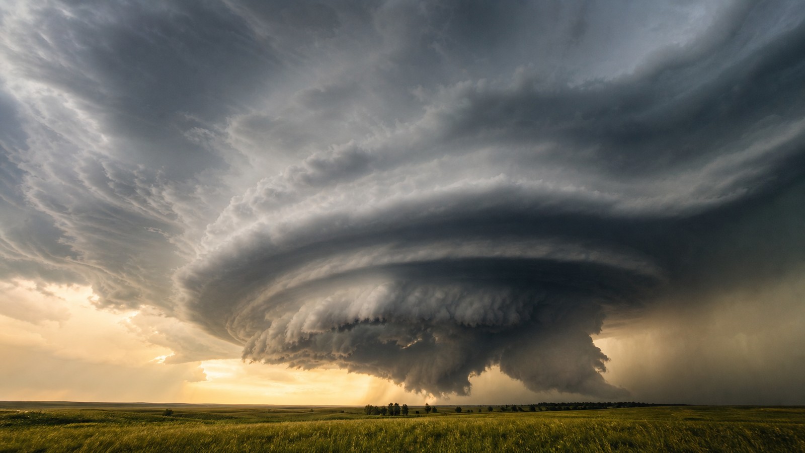
A supercell is a thunderstorm with a persistent rotating updraft. Because the updraft and downdraft regions are organized, the storm can last much longer than an ordinary pulse thunderstorm. That long-lived structure gives rotation time to intensify, cycle, and interact with air near the ground.
Many significant tornadoes form near the rear flank of a supercell, close to the boundary between warm inflow and cooler outflow. The details are complex, and not every supercell produces a tornado. The near-ground temperature, humidity, downdraft character, and storm-scale pressure field all influence whether rotation can tighten at the surface.
Supercells deserve respect because they can produce multiple hazards at once: tornadoes, giant hail, damaging wind, intense rain, and frequent lightning. A storm does not need to show a tornado immediately to be dangerous.
Not All Tornadoes Come From Supercells
Some tornadoes form along squall lines where small circulations spin up on the leading edge of damaging winds. These tornadoes are often shorter-lived and harder to warn for, but they can still cause serious damage. Tropical cyclones can also produce tornadoes in outer rainbands, especially where low-level shear is strong.
Landspouts form differently from classic supercell tornadoes. They often develop when a growing thunderstorm stretches preexisting rotation along a boundary near the ground. Waterspouts can form over water, sometimes under relatively small showers, though tornadic waterspouts can also be linked with severe storms.
These varieties show why tornado formation is a family of processes rather than one single recipe. The common thread is rotating air being stretched into a damaging surface circulation. The storm type controls how that stretching occurs.
Why Some Rotating Storms Never Produce Tornadoes
Many storms rotate aloft without producing a tornado because the rotation never intensifies at the ground. The downdraft may be too cold and stable, cutting off warm inflow. The storm may be slightly displaced from the best shear. The updraft may weaken before low-level rotation tightens. Small changes can decide whether a mesocyclone stays elevated or becomes tornadic.
The lowest few thousand feet of the atmosphere are especially important. Warm moist inflow can help keep air buoyant near the ground, while strong low-level shear can support rapid spin-up. If the storm’s outflow becomes too cold, it can undercut the circulation and reduce tornado potential. If the outflow is not too cold, it may help focus rotation instead.
This is one reason tornado forecasting is difficult. Meteorologists can identify environments favorable for tornadoes, but the final step depends on storm-scale details that evolve minute by minute. A warning decision often relies on radar trends, spotter reports, environmental analysis, and caution.
Tornadoes Are Rated After the Damage
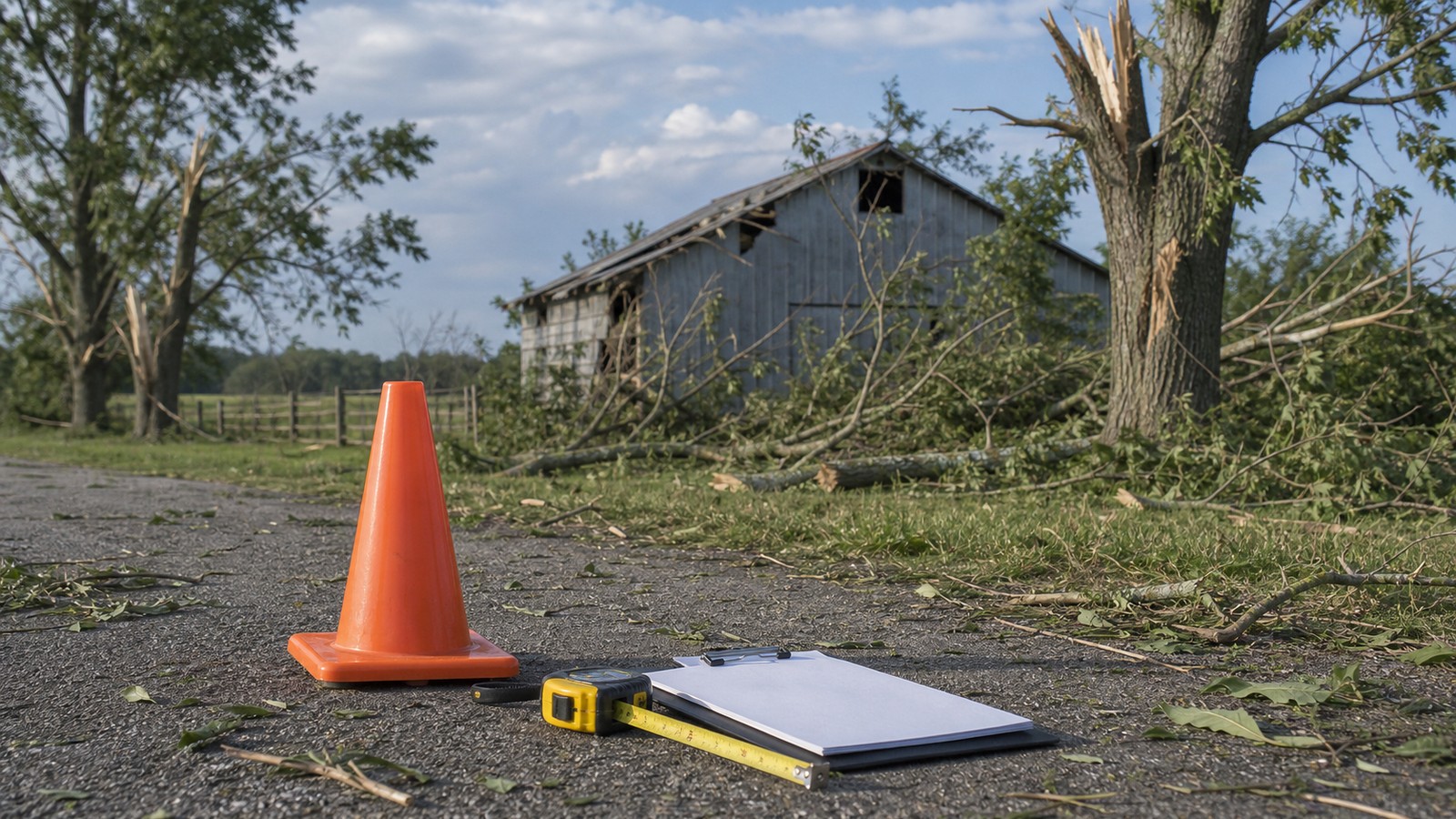
Tornado strength is not measured directly in most cases because instruments rarely survive in the strongest part of the circulation. In the United States, tornadoes are rated with the Enhanced Fujita scale after survey teams examine damage indicators. The rating estimates wind speed from the kind and severity of damage.
That means a tornado’s rating is partly limited by what it hits. A violent tornado crossing open fields may leave less evidence than one striking well-built structures. Survey teams account for available clues, but the rating describes observed damage, not a perfect measurement of peak wind everywhere along the path.
This also explains why safety should not depend on a predicted category. You will not know the final EF rating while the storm is approaching. A tornado warning means shelter now, whether the tornado later receives a low or high rating.
How to Respond to Tornado Formation Risk
When conditions favor tornadoes, identify shelter before storms arrive. The safest place is a basement or an interior room on the lowest floor of a sturdy building, away from windows. Mobile homes, vehicles, and open outdoor spaces are dangerous during tornado warnings. Helmets, shoes, and a way to receive alerts can help reduce injury risk.
Do not wait outside to watch the storm if a warning includes your location. Tornadoes can change direction, become rain-wrapped, or form quickly from a storm that looked merely dark a few minutes earlier. The sky is not a reliable warning system by itself.
Understanding how tornadoes form is useful because it explains why warnings can feel sudden. The final tightening of a circulation may happen quickly. Preparation belongs before the warning, not after the funnel is visible.
The Life Cycle Can Be Brief or Long
A tornado may last less than a minute or remain on the ground for more than an hour. Short-lived tornadoes can still damage roofs, trees, power lines, and vehicles, especially if they hit vulnerable structures. Long-track tornadoes require a storm that repeatedly maintains or regenerates low-level rotation as it moves through a favorable environment.
Many tornadoes go through visible stages. A funnel may descend, debris may appear near the ground, the vortex may widen or become wrapped in rain, and then the circulation may narrow into a rope shape as it weakens. These stages are not guaranteed and can occur too quickly for safe observation.
A storm can also cycle. One tornado may dissipate while the parent supercell reorganizes and produces another nearby. That is why leaving shelter the moment one circulation passes can be risky if the warning continues or another storm-scale rotation is approaching.
False Visual Cues Create Risk
Some clouds look frightening but are not tornadoes. Scud clouds can hang low under a storm base and move rapidly in turbulent inflow. Rain shafts can look like gray columns. Shelf clouds can create dramatic wedges along gust fronts without being rotating tornadoes. Visual identification is difficult even for trained observers when rain, darkness, or terrain interferes.
The opposite problem is more dangerous: a real tornado may look unimpressive or be hidden. A narrow rope can still damage what it hits. A rain-wrapped circulation may show only blowing debris. A nighttime tornado may reveal itself only through power flashes or warning information, and power flashes are not reliable proof by themselves.
Because visual cues can mislead in both directions, warnings and radar-supported information should guide shelter decisions. Looking outside can satisfy curiosity, but it should not overrule an alert that places your location in danger.
Watches and Warnings Fit the Formation Timeline
A tornado watch means the broader environment can support tornado-producing storms. It is the time to charge phones, review shelter options, bring pets inside, and make sure everyone knows where to go. A watch may cover many counties because it is based on ingredients that could produce storms over several hours.
A tornado warning is different. It means a tornado is occurring or is possible soon based on radar, reports, or both. The warning is tied to a more specific storm and location. When your location is inside the warning area, the formation question has moved from possible to urgent.
Understanding that difference helps people respond at the right pace. Watches are for readiness; warnings are for shelter. Waiting until the storm is visible collapses that timeline and gives the tornado the advantage. Preparedness is what restores those lost minutes.